MoDOT Location Survey
Johnson County, Missouri, Missouri Department of Transportation
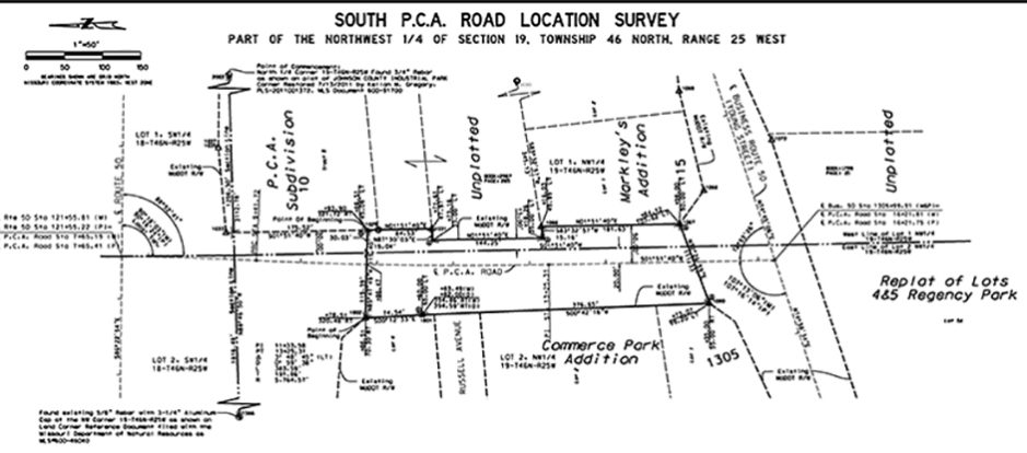
The Affinis survey team worked with the Missouri Department of Transportation (MoDOT) to establish the existing right-of-way lines for 18 miles of Highway 13 in Warrensburg, Missouri. The goal was to prepare this information so MoDOT could transfer the routes to the City of Warrensburg. To make the change, MoDOT’s process requires that a current boundary survey of the right-of-way be performed and issued on a plat of survey.
There were 100 United States Public Land Survey (USPLS) corners recovered as part of the right-of-way establishment of this survey. USPLS corners were preserved with current reference tie measurements, state plane coordinates, and descriptions. They were then filed with the state surveyor’s office.
The highway corridor was originally described off of its centerline with left and right calls to the right-of-way. Because of this, we located and surveyed original centerline, comparing the measured data to as-built plan data. Once that was complete, we wrote perimeter metes and bounds descriptions of the corridor tied to the section lines and referenced the original centerline deeds as the parent source. The results of the survey were presented on a Plat of Location Survey and filed at the county courthouse.