Remote Survey Technology Key in Rail Line Repair
Posted on Wednesday, October 6th, 2021 by Affinis CorpIn Railroad, tagged in
In rural Missouri, a track inspector was making his rounds on July 5 when he discovered a section of track had settled. In its current condition, it wasn’t safe for use. However, many local farmers were in the middle of harvest, and their grain was ready to be transported. The railroad was looking for a partner who could begin work immediately and keep up with the tight turn-around of this emergency effort.
Because our co-workers have an existing relationship with the railroad company, they contacted us immediately. We pulled together a three-person survey crew and started work right away, driving several hours to the project site. Our ability to start quickly helped us meet the project’s tight schedule.
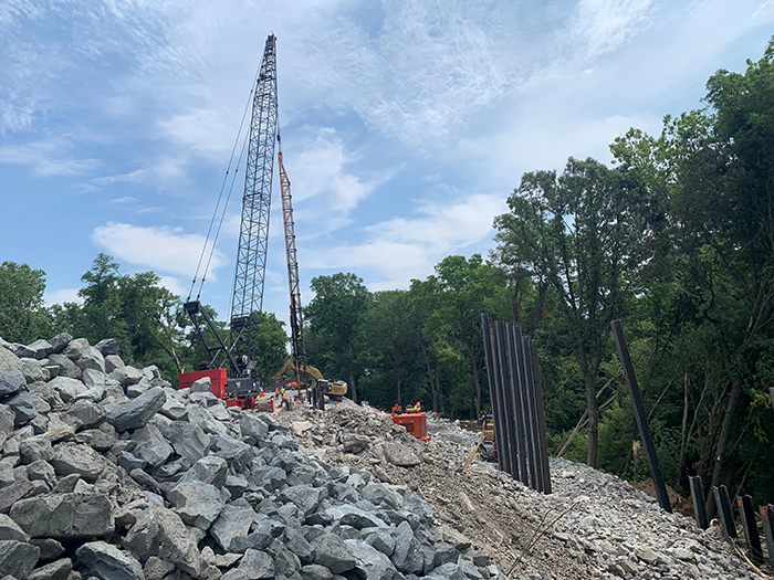
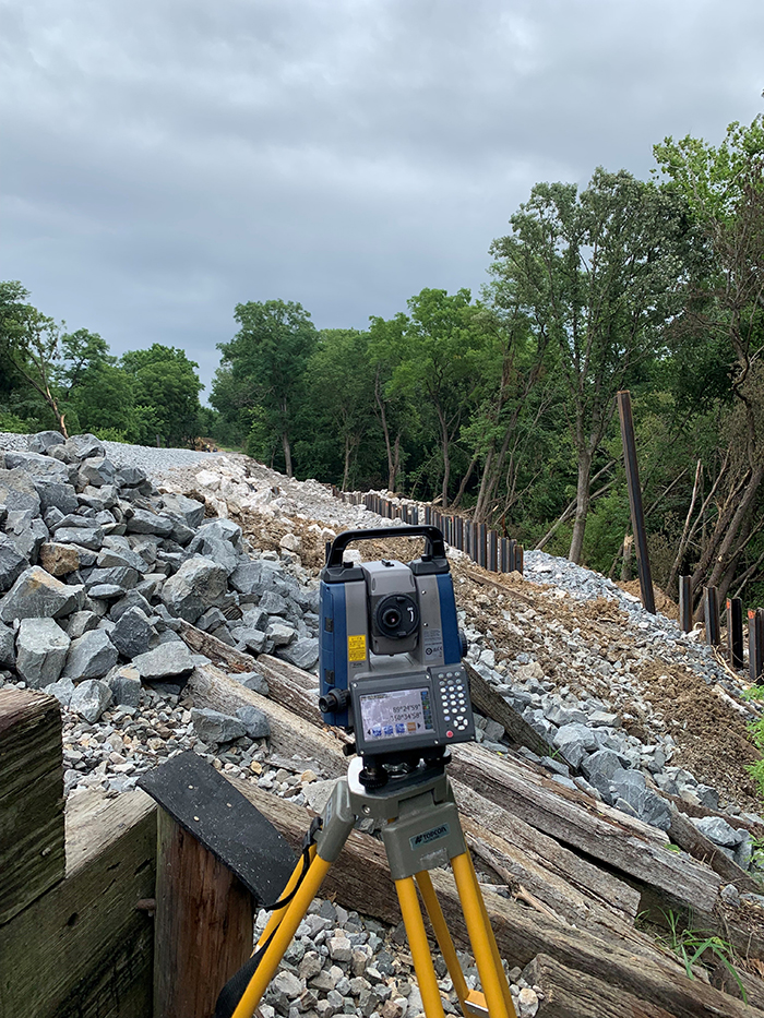
The railroad planned to add piling and rip rap to raise the line again. To make these changes, our client needed surveys of the current conditions. We started by setting control and creating a topographic map of the existing site. We also used valuation maps, so the railroad could understand the current alignment. In addition, our surveyors found the right-of-way boundaries. This helped all parties better understand where they could and couldn’t work. Then, all these components were given to the railroad’s engineer, so they could design a solution.
One of the keys to our survey team’s success was they were able to leverage our existing equipment. In the field, we had the capability to create a surface model using the topographic information we had collected in real-time. This was particularly valuable when working with the railroad’s dirt consultant. Using our models, they could tell how many cubic yards of dirt were necessary. This cost-effective strategy saves time and reduces waste.
Remote technology was critical during construction as well. Once an acceptable model was created, we were able to provide it, so the contractor could upload it to the bulldozers with GPS in their units, if they’d like. Using that data, they could see where and how to make each cut. This ability would enable the contractor to complete the work without multiple calls to the surveyor for additional staking, reducing the overall cost to the railroad.
Moving from the top to the bottom of embankment to get measurements was challenging. As we worked around the rip rap, we relied on our safety training to gather the data points we needed. We also used our drones to map the site while it was under construction. This allowed us to share current information with executives as it was happening.
During construction, we placed stakes to show the contractor where to build the embankment. Our training and expertise allowed us to work simultaneously around the construction activity with no incident.
Once the track was in place, our survey team over-time measured the top of the rail and top of the piling to monitor any additional movement. Then, we set points along the rail line to use as controls. Each month, we return to the site to see if it is staying in place and not settling. We’ve been asked by the railroad to continue this service through December.
Drawing on our past experience, we were able to complete the project in two months. To work within the railroad’s tight schedule, we leveraged our remote tools to build efficiencies in the field. Our ability to relay data to the cloud from the field and evaluate it in real-time provided great efficiency. With a safe and effective line in place, the railroad can once again support the demands of this agricultural area, helping to move this community forward.