Affinis Surveyors Help Preserve 200-Year-Old History
Posted on Wednesday, February 22nd, 2017 by Affinis CorpIn Survey, tagged in
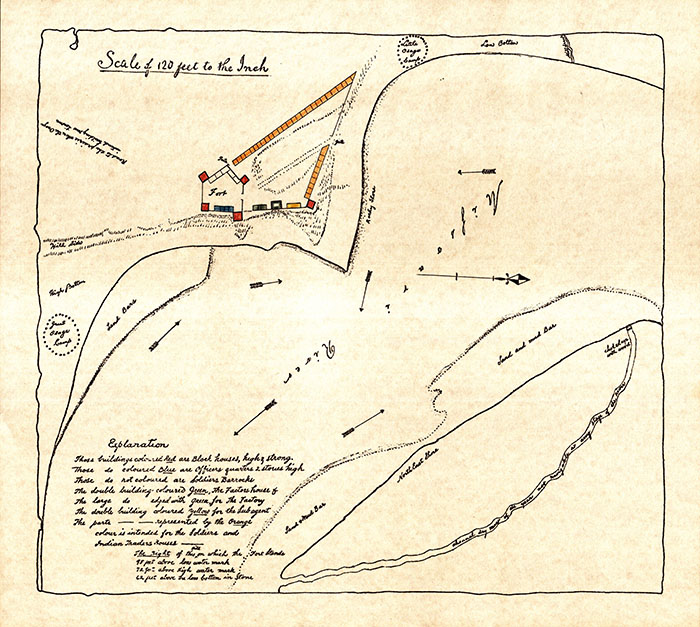
2016 marked the 200th anniversary of the running of the Osage Treaty Line. This was the first boundary survey line in what is now western Missouri. To commemorate the event, members of the Missouri Society of Professional Surveyors (MSPS) led the charge in retracing historic steps to find it.
While the exact location was unknown, the negotiated boundary line was described in the Treaty of Fort Clark, also known as the Osage Treaty of 1808. In this treaty, Indians ceded all lands east of a line extending from Fort Clark on the south bank of the Missouri River to the Arkansas River (near what is now Fort Smith, Arkansas). While the treaty was signed in 1808 by the United States and chiefs of the Greater and Little Osage Nation, the actual survey line was run by Deputy Surveyor Joseph C. Brown in 1816 between August and October.
The project was conducted by volunteers over the course of six months. To help with the effort, members of the Affinis survey team researched notes and survey data from as far back as 1808. They also visited Fort Osage with the other volunteers to look for evidence of the initial point of the 1816 survey. During that trip, Affinis survey members located physical objects on the ground (trees and gate posts) believed to have been described by Joseph C. Brown in his 1816 surveyor’s notes. Additional points were also searched for in Jackson, Cass, and Bates counties. The distance and direction of the collected points were compared to the 1816 survey notes and plats. After reaching a reasonable conclusion of the line’s location, the volunteers began planning two separate events to commemorate both the line and the surveyor.
“It was interesting to read documents and look for evidence dating back to 1808. While we often use historic records in our work, this project was unusual. Although there were notes that divided up all the lands before the government surveys were completed, the old notes had no reference to the surveys,” said Robert Ubben, PLS, Principal, Survey Services.
Two commemorative stones were made and positioned on the treaty line in August of 2016. One was placed inside of Fort Osage on the calculated treaty line. The second stone was put on the calculated line near Stark City, MO.
You can see these pieces of history for yourself inside of Fort Osage in Jackson County or at 26792 Oak Road in Stark City, Missouri.