New HyDrone Equipment Increases Safety and Accuracy for Survey Team
Posted on Wednesday, October 14th, 2020 by Affinis CorpIn Survey, tagged in
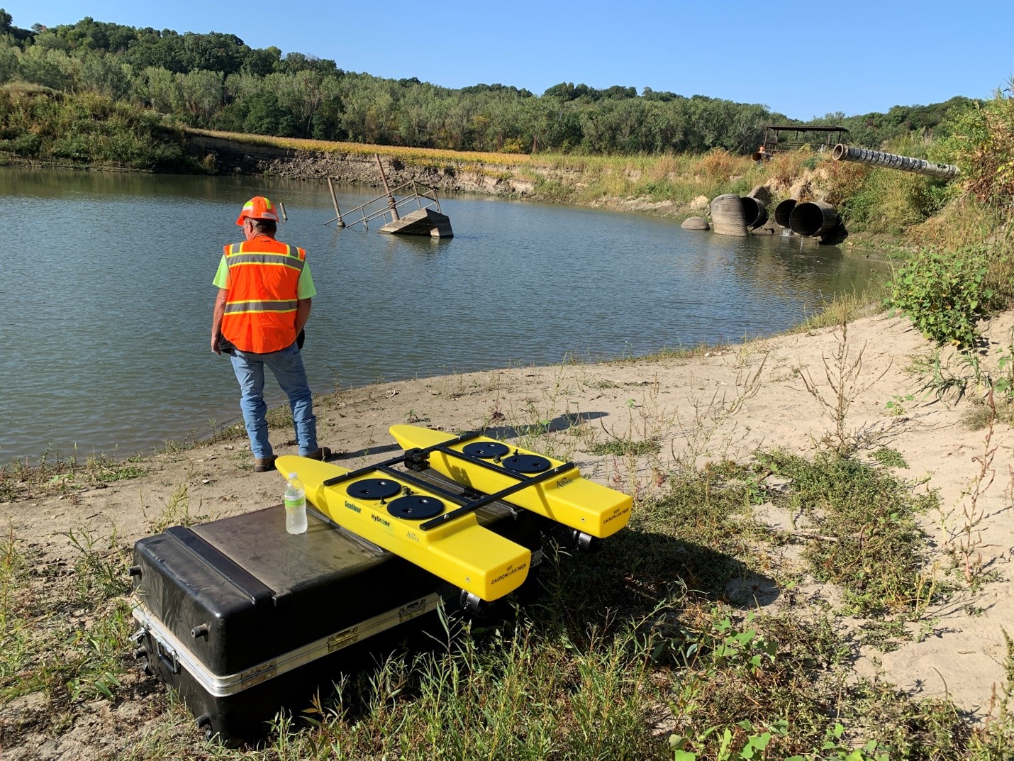
The Affinis survey team has been using a new, remote-controlled Unmanned Survey Vessel (USV) to gather measurements on bodies of water. This new tool, called the HyDrone, increases safety, efficiency, and accuracy in the field. We recently asked Garrett Spease, Field Crew Member and GIS Specialist, to share more about how it’s used and why it stands out.
Could you tell us a little about the HyDrone?
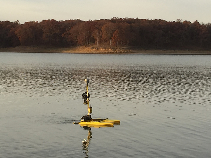
The HyDrone is a portable, catamaran platform that can be carried by a single person. The boat is comprised of two pontoons connected by a metal bracket. It’s battery powered and remote controlled.
Measuring equipment can be mounted to the HyDrone, allowing our team to capture horizontal locations and depths of water. Specifically, we use a single beam sonar unit called Seafloor Hydrolite-TM. The single beam sonar is paired with a Real Time Kinematic (RTK) GPS receiver and data collector tablet to measure and store data. When paired with our existing GPS receiver and data collector, we can gather depth measurements and calculate elevations of the bottom of bodies of water.
Why did you get it?
We purchased this equipment to make hydrographic surveys easier and safer. This system allows us to get in shallower depths of water, collect data more accurately and quickly, is easier to transport and mobilize than other larger vessels, and helps with avoiding license, permit, and horsepower limits imposed by some jurisdictions. Because the USV is small and compact in size, the vessel and equipment can be easily transported without a trailer. It is safer for us to use, because with it, our staff isn’t out on the water or exposed to contaminated water, such as a sludge pond.
How long have you had it?
For the last 6 years, we have rented this equipment for projects and purchased ours in June. We had rented it frequently enough that we felt justified in buying one for our team.
What does it do?
This new equipment, paired with our existing GPS receiver and data collectors, allows us to collect depth measurements and calculate elevations of the bottom of bodies of water. Measurements in bodies of water are often made for the purpose of calculating volumes of silt or dirt. For example, we could measure a lake every 6 months for a period of years and calculate the volume of silt buildup caused by upstream erosion filling the lake. Or, if the lake was dredged, we could then go back and measure the depths to calculate the volume of silt removed.
How do you use it?
First, we use it to establish a horizontal and vertical control point or network of points near the project. After a control is established, a GPS base station is set up to communicate with a roving GPS unit on the remote boat. When the GPS data is running, we pair it with the Hydrolite-TM echosounder and test that all data is being received in a data collector. After it is verified that horizontal data is being received correctly and the echosounder is measuring depths, the USV is ready to go in the water and begin collecting data.
How does it benefit clients?
This new equipment will benefit clients, because with it, we need fewer people on site to collect data. It can go in shallow bodies of water that a normal boat can’t enter or cross over. The unit can be set to collect and store the data by time or distance. For example, we can set it to collect a depth for every 10 feet the boat moves or every 1 foot the boat moves. We can ask it to collect data every 5 seconds or every 30 seconds. Data can be gathered more densely to create a better mapping product of the floor of the body of water with no change in how long it takes to collect the data. This unit saves time and reduces manpower.
How does this enhance or change the survey team’s capabilities?
We now have the ability to collect data with fewer people, using less equipment, more accurately and quickly, and on short notice. The big enhancement is the greater amount of coverage we can get and the accuracy added to the measurements.
Have you used it on projects yet? If so, how many?
We have used this equipment on the White Cloud, KS MRLS 500-R levee rehabilitation project and on the Crawford County, Kansas KDOT bridge project.
Anything else we should know about it?
The USV and the Hydrolite system operate separately. This gives us the capability to attach the Hydrolite system to any water vessel manned or unmanned. If a body of water is moving too fast for the remote boat, we can mount the system on our larger boat or any other boat.